|
|
WARNING/DISCLAIMER: Hiking can be dangerous and the information furnished below may contain errors! |
Anthony's Nose Hike
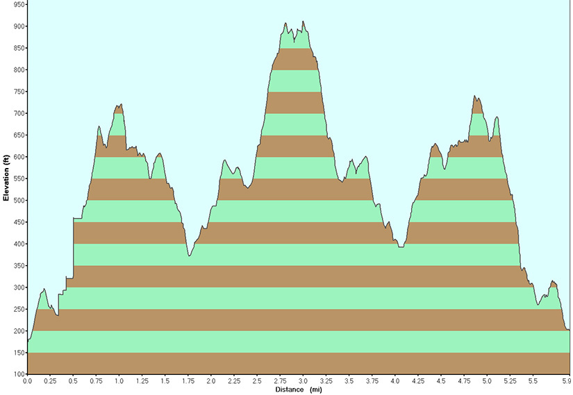
Total Distance: approximately 6 miles
Difficulty: medium - difficult (hilly/steep/rocky terrain, about 1,500'
elevation gain)
Estimated hiking time: 3.5+ hours - individual, 5.5 hours - group
Take the Camp Smith Trail (blue blazes) which starts just near the restroom by the toll house (north of the parking area) north for approximately 3.2 miles. Just after the summit on Anthony's Nose a left leads to a panoramic view of the Bear Mountain Bridge, Bear Mountain-Harriman State Park and the Hudson River. This is also the turnaround point for the hike. Retrace your steps back to the parking area.
Alternative #1: Leave a car at a parking area about 1.9 miles north of the starting point to create various shorter alternatives.
Alternative #2: Leave a car parked on the east side of Route 9W North next to the Appalachian Trail (white blazes) to create a one way hike and other alternatives.
Note / Caution: The Camp Smith Trail's trail markings (blazes) are decent / satisfactory but rarely any better and sometimes worse. Combined with their color, they are not always the easiest to spot.
REFERENCES: 50 Hikes in the Lower Hudson Valley p.55-59 (similar hike), NY-NJTC Map #1 or 101 (East Hudson Trails)
Driving Directions from NYC
From NYC take the George Washington Bridge to the Palisades Interstate Parkway (going north). Take the Palisades Interstate Parkway for about 40 miles until its end at the Bear Mountain Bridge. Cross the Bear Mountain Bridge and make a right onto Route 6 / 202 (south).
Take Route 6 south for 2.6 miles and park in the parking lot of the Bear Mountain Bridge Toll House on the left (northbound) side of Route 6 (GPS: N 41.301154, W 073.95121).
The total driving time is estimated at one hour without traffic.
Click here for What to Bring on a Hike
Click here for Information for Group Hikes
Questions: Michael Brochstein
 |
 |
|
| Bear Mountain Bridge Toll House (June 2005) | ||
 |
 |
|
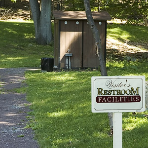
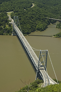
| Restroom near Toll House. Camp Smith Trail starts to the left of the restroom (not shown). (June 2005) | The Bear Mountain Bridge as seen from Anthony's nose. (June 2005) | |
 |
||
|
View of the Hudson River from the Camp Smith trail. (June 2005) |
||
 |
||
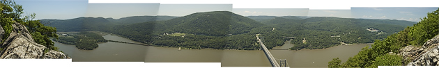
| View of the Hudson River and Bear Mountain Bridge from Anthony's Nose. (June 2005) | ||
 |
 |
|
|
Another hiker on the trail. (June 2005) |
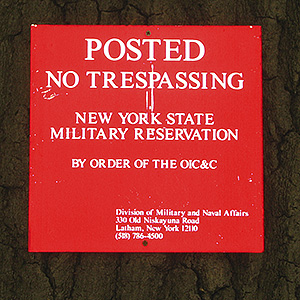
Camp Smith is just inland from the trail. It is an active NY National Guard training area (keep out!). (May 2006) | |
 |
||
| Signs along the Camp Smith Trail to encourage you to keep on the trail and off Camp Smith property which is adjacent to the trail. (January 2012) | ||
 |
||
Last updated: 1/2012
Copyright © 2009-2012 Michael Brochstein. All rights reserved.