|
|
WARNING/DISCLAIMER: Hiking can be dangerous and the information furnished below may contain errors! |
Beacon Hills & Views
Total Distance: approximately 10 miles
Difficulty: medium+ (hills!, 2,250'+ total elevation gain)
Estimated hiking time: 5.5+ hrs - individual, 6.5+ hrs - group
From the parking area take the unpaved road heading uphill / eastward (away from Route 9D). You will soon see a long set of stairs that extends in multiple sections up the hill in front of you. Take the stairs and on top of the stairs, upwards, to your left, you will see the red blazed Casino trail. Continue onto this trail.
After you are about 0.4 miles from the parking area veer left onto the yellow trail (when the red trail makes a hard right turn) and take it (for about 0.9 miles) until you intersect the white blazed Fishkill Ridge Trail. Veer right onto the Fishkill Ridge Trail and continue on this (passing a blue trail on your right) for about 4 miles until it ends where it intersects the yellow blazed Wilkenson Memorial trail. Continue straight onto the Wilkenson Memorial trail and take it for about 1.9 miles until you intersect the red blazed Casino trail.
Make a left onto the Casino Ridge trail and take it for about 0.2 miles until you reach the white blazed Breakneck Ridge trail. Make a left onto the Breakneck Ridge trail and take it for 0.2 miles until the South Beacon Mountain Lookout Tower. Take in the 360-degree view there and then reverse course on the white blazed Breakneck Ridge trail and take it back to the Casino Trail. Make a left onto the Casino Trail and take it for about 1.9 miles back to the parking area.
NOTE: As with many places in this part of the country, there is poison ivy growing in this area (a word to the wise,...).
REFERENCES: NY-NJTC Map #102 (East Hudson Trails, 2008 edition)
Driving Directions from New York City
From NYC take the George Washington Bridge to the Palisades Interstate Parkway (going north). Take the Palisades Interstate Parkway for about 40 miles until its end at the Bear Mountain Bridge. Cross the Bear Mountain Bridge and make a left onto Route 9D (north).
After driving about 8.5 miles north on Route 9D you will reach an intersection in Cold Spring which crosses Route 301. Keep driving north on Route 9D and in about 2 miles you will drive through an underpass (with Breakneck Ridge above it). Keep going another 4 miles until you reach the parking area on your right for Mount Beacon Park. Park in this parking area. (GPS: N 41.49337 W 73.96020).
The total driving distance is about 60 miles from the Upper West Side of NYC and the driving time is estimated is a little over one hour without traffic.
Public Transportation
None for this hike exactly but there is a train from Grand Central Station that goes to the nearby town of Beacon.
Click here for What to Bring on a Hike
Click here for Information for Group Hikes
Questions: Michael Brochstein
 |
 |
|
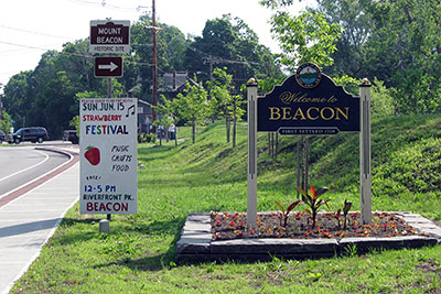
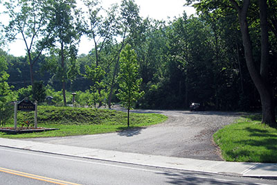
| The view of the entrance to the parking area from Route 9D (June 2008). | Sign at the entrance to the parking area from Route 9D (June 2008). | |
 |
 |
|
| The parking area from Route 9D (June 2008). | The unpaved road that starts the hike (June 2008). | |
 |
 |
|
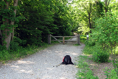
| Someone watched me at the start of the hike (June 2008). | The stairwell at the start of the hike (June 2008). | |
 |
 |
|
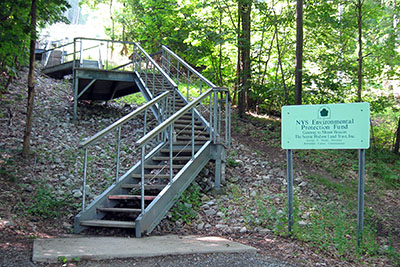
| The stairwell at the start of the hike (June 2008). | The stairwell at the start of the hike (June 2008). | |
 |
 |
|
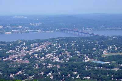
| One of many views along the hike (June 2008). | The lookout tower on South Beacon Mountain (June 2008). | |
 |
||
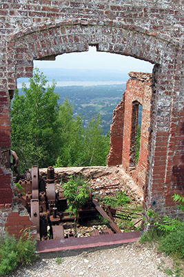
| Remains of an old railway that went up the mountain from Beacon (June 2008). | ||
|
|
||
| The path of this hike (June 2008). | ||
|
|
||
| Hills! (June 2008) | ||
Last updated: 6/2008