|
|
WARNING/DISCLAIMER: Hiking can be dangerous and the information furnished below may contain errors! |
Bearfort Ridge Hike
Total Distance: about 8.3 miles
Difficulty: moderate plus, some rock scrambling, hilly
Estimated hiking time: 5+ hrs (individuals), 6.5-7+ (groups)
Take the Bearfort trail (white blazes) until it's northern terminus where you will intersect the Ernest Walter trail (yellow blazes). Make a left onto the Ernest Walter trail and take it to its terminus where it meets the Appalachian Trail (white blazes). Make a right onto the AT and follow it north to "Grand View" (a set of excellent east facing viewpoints). Eat lunch here (about 60% at most time wise into the hike).
Turn around here and retrace your steps southward on the AT. Make a left onto the State Line trail (blue blazes). Take it to the other northern terminus of the Ernest Walter trail. The SL trail will take longer than expected (based on the map). Make a right onto the Ernest Walter trail and it to the northern terminus of the Quail Trail (orange blazes). At Surprise Lake make a left onto the Quail trail and take it until its southern terminus where it meets the Bearfort trail. Make a left onto the Bearfort trail and take it south until the road.
REFERENCES: NY-NJTC Map #21 (North Jersey Trails), Circuit Hikes in Northern New Jersey (similar hike in reverse direction in 5th edition) p.103-108
Driving Directions to Bearfort Ridge Trailhead
From NYC take the George Washington Bridge to Route 80 West. Take Route 80 about 20 miles to Exit 53 in order to get onto Route 23. Take Route 23 North for about 16.5 miles to the town of Newfoundland. In Newfoundland turn right onto Route 513 North (a.k.a. Union Valley Road). Take Route 513 north for about 9 miles.
The following sections are very tricky and poorly marked, please pay attention;
In the town of West Milford, bear left at the fork in order to stay on Route 513 / Union Valley Road (going right will put you on Marshall Hill Road). (If you miss this turn then you will come to the intersection of Marshall Hill Road and Lincoln Avenue. At this point bear left onto Lincoln Avenue.) In about a mile you will come to a fork in the road where Union Valley Road goes right and White Road goes left, stay (right) on Union Valley Road.
At the end of Union Valley Road (or Lincoln Avenue!) it merges into Warwick Turnpike. Make a hard left onto Warwick Turnpike (heading west). If you miss this very hard left then you will see a gas station and an A&P supermarket on the right. If this happens then make a U-turn and you will be heading the correct way on Warwick Turnpike. In less than one-half mile (initially uphill, or 1+ mile if coming from Lincoln Avenue) is a very small concrete bridge (just before White Road).
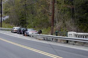
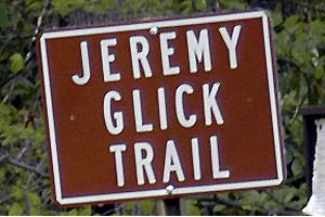
The parking area is on the westbound (right) side of Warwick Turnpike on the western (far) side of a small concrete bridge (you can see White Road from the parking area). The trailhead is on the eastern (near) side of the bridge. There is a sign at the trailhead that is visible from the road that reads "Jeremy Glick Trail". (GPS: N 41.15562, W 074.36234).
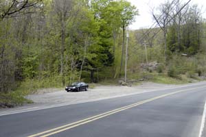
If this parking area is full then there are other pullouts ahead on the right and a large pullout on the eastbound (left) side of the road approximately 50+ yards east of the bridge (where you came from). The later is recommended if necessary. The total driving time is estimated at 1.25 hours without traffic and is about 51.5 miles.
Alternative Driving Directions (might be easier to follow given the poor signage in NJ): Take the George Washington Bridge to the Palisades Interstate Highway heading North. In about 19 miles exit the parkway at exit 9W onto the Thruway (Route 87/287) which heads west. About 10 miles later, exit the Thruway at exit 15A. At the exit turn left onto Route 17 North. After about 4.9 miles you will see the Tuxedo (Park) Train and Police Stations on your right. Continue straight. In about 2.5 more miles turn left onto Route 17A West. Take Route 17A until it intersects with Route 210. When Routes 210 and 17A diverge, make a left onto Route 210 heading south. Route 210 turns into Route 511 at the New York - New Jersey border. Continue south on Route 511 until the Warwick Turnpike. Make a right onto Warwick Turnpike. Follow detailed directions listed above.
Click here for What to Bring on a Hike
Click here for Information for Group Hikes
Questions: Michael Brochstein
|
|
 |
|
| Parking area just past (west of) concrete bridge (shown above) on westbound side of road.. | Trailhead is just before (east of) concrete bridge. Sign on brown sign says "Jeremy Click Trail" (see photo below). | |
 |
 |
|
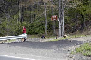
| Alternate parking area about 50 yards east of concrete bridge on the eastbound side of the road. | Sign at trailhead. | |
 |
||
|
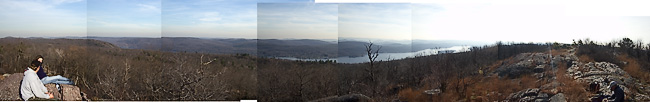
View of Greenwood Lake from "Grand View" on Bearfort Mountain (November 2003). |
||
 |
 |
|
|
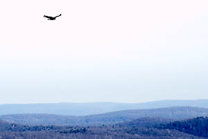
Bird watching from "Grand View" |
The State Line Trail. |
|
 |
 |
|
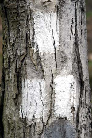
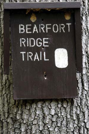
| Terminus blaze for Bearfort Ridge Trail near trailhead at roadside. | Sign at terminus of Bearfort Ridge Trail near road. | |
 |
 |
|
|
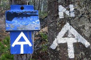
The New York / New Jersey border. |
The Appalachian Trail |
|
 |
||
|
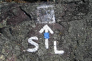
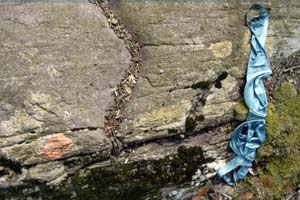
When on the Quail Trail make sure to follow the orange blazes (lower left), not the temporary blue markers. |
||
Last updated: 1/2007