|
|
WARNING/DISCLAIMER: Hiking can be dangerous and the information furnished below may contain errors! |
Black Rock Forest Hike
Total Distance:
approximately 8.6 miles
Difficulty: medium
(moderate/rolling hills, 1500'+
total elevation gain)
Estimated hiking time:
4.5 hours - individual (5.5+ group)
Take the Mine Hill trail (yellow diamond shaped blazes) from the parking area uphill for a short while until an intersection. Make a left onto the Sackett trail (yellow circle shaped blazes) and take this until the Sackett trail ends where it meets the Stillman Trail (yellow rectangle shaped blazes). Make a left onto the Stillman trail and take it until Black Rock.
Continue on the Stillman trail passing a white trail on your left until you meet the Scenic trail (white blazes) on your right. Make a right onto the Scenic trail. Make a right onto the Spy Rock trail (blue blazes) to see the view from Spy Rock. Retrace your steps and and make a right onto the Scenic trail to continue in the direction you were heading.
Make a left onto the Stropel trail (yellow blazes) and then a right onto the Rut trail (red blazes) to get to Eagle Cliff. After seeing the view take the Eagle Cliff trail (blue blazes) back to the Scenic trail and make a left to continue on it.
Make a right onto the Arthur trail (yellow rectangular shaped blazes). At the end of the Arthur trail veer right onto the Compartment trail (blue blazes). The Compartment trail will coincide with the Stillman Trail (yellow rectangle shaped blazes) for a short while. Stay on the Stillman Trail when the Compartment trail heads right. Do not go onto the Short Cut trail (yellow triangular shaped blazes).
Take the Stillman trail until you reach the Sackett trail (yellow circle shaped blazes) on your right. Make a right onto the Sackett trail and then a left onto the Mine Hill trail to get back to the parking area.
REFERENCES: NY-NJTC Map #113 (West Hudson Trails)
Driving Directions from New York City
From NYC take the George Washington Bridge to the Palisades Interstate Parkway (going north). Take the Palisades Interstate Parkway for about 40 miles until its end where you pick up Route 9W North at a traffic circle just before the Bear Mountain Bridge.
Take Route 9W North for about 9+ miles until Angola Road. Angola Road is a right hand exit, make a left turn onto Angola Road. Drive southwest on Angola Road for about 1.5 miles. Make a left onto Mine Hill Road and drive about 0.9 miles on Mine Hill Road (always heading in the direction of the "Dead End") until the turnout/parking area on the right (N 41.40233, W 74.04725). The trail begins opposite the uphill end of the turnout and is marked my three yellow diamonds. If you reach a dead end then you've gone about a quarter mile or so too far.
The total trip is a little under 60 miles and the driving time is about one hour without traffic. Note that the parking area is small (6-8 cars max).
Click here for What to Bring on a Hike
Click here for Information for Group Hikes
Questions: Michael Brochstein
 |
 |
|
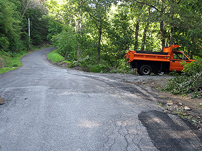
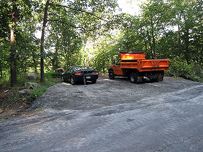
| The parking area on the right as you should see it approaching it from the correct direction (August 2008). | The parking area as you might see it on your right if you've driven past it (August 2008). | |
 |
 |
|
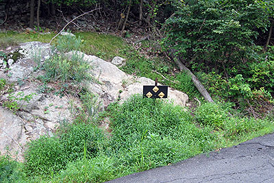
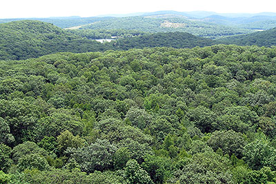
| The three yellow diamonds indicate the start of the Mine Hill trail, opposite and very slightly uphill from the parking area (August 2008). | A view from Eagle Cliff (August 2008). | |
 |
||
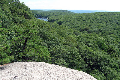
| A view from Eagle Cliff (August 2008). | ||
 |
||
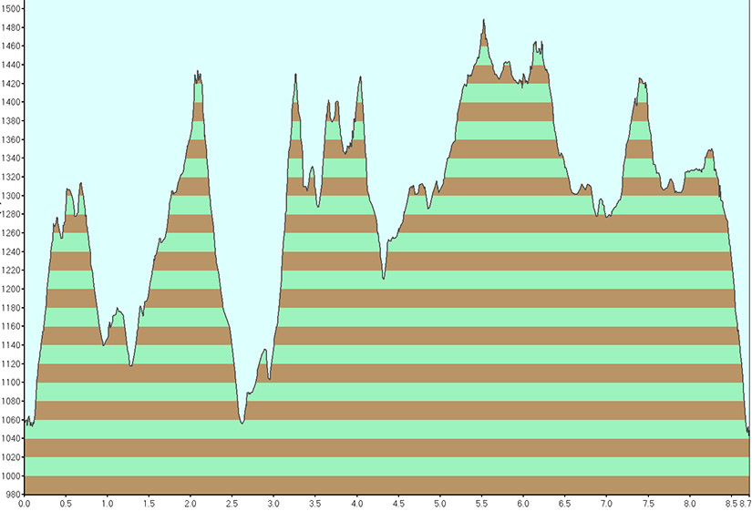
| Elevation profile for hike. | ||
Last updated: 4/2009