|
|
WARNING/DISCLAIMER: Hiking can be dangerous and the information furnished below may contain errors! |
Car Pond Mountain Hike
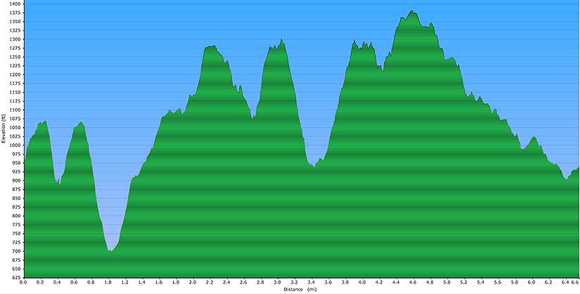
Total Distance: 6.6 miles
Difficulty: medium (1,600'+ total elevation gain)
Estimated hiking time: 4+ hours
Take the White Bar trail (white blazes) uphill from the parking area (do not cross the road). The White Bar trail merges with the Triangle trail (yellow blazes). Follow the combined trail. When they split, stay on the Triangle trail until it merges with the Ramapo-Dunderberg trail (RD, red blazes). Continue on the combined trail a short way until they split. When they split stay on the Ramapo-Dunderberg trail. The Tom Jones Shelter is off to the right side of the RD, not long after passing the Victory trail.
After crossing County Road 106, turn right, walk about 100+ yards and just after crossing over a stream you will see more blazes in the woods on the far side of the road for the RD trail (there are probably a few missing blazes around here!).
Take the RD trail north until you intersect the Dunning trail (yellow blazes). The Bald Rocks Shelter is off the right side (about 100 feet or so) of the RD not long before its intersection with the Dunning trail. Make a left onto the Dunning trail. Take the Dunning trail until you intersect the White Bar trail. Make a left onto the combined Dunning and White Bar trails (don't go onto the uncombined White Bar trail at this junction). After they split, take the White Bar trail south, back to the parking area. Do be careful when on the White Bar trail as it combines briefly with the Nurian trail for a while which also has white colored trail markings.
REFERENCES: New York - New Jersey Trail Conference Map #118 (Southern Harriman-Bear Mountain Trails )
Driving Directions from NYC
Take the George Washington Bridge to the Palisades Interstate Highway heading North. In about 19 miles exit the parkway at exit 9W onto the Thruway (Route 87/287) which heads west. About 10 miles later, exit the Thruway at exit 15A. At the exit turn left onto Route 17 North.
After about 4.9 miles you will see the Tuxedo (Park) Train and Police Stations on your right. Continue straight.
In about 2.5 more miles turn left onto Route 17A West. Very very soon after making this left, at the top of the ramp, at the intersection just past the turnoff for Route 17A, make a right onto County Route 106 which goes over (via an overpass) Route 17 and then under the NYS Thruway.
Take County Route 106 for about 2.4 miles. Park in the parking area on your right (where you should find blazes for the White Bar trail, GPS: N 41.23506, W 74.14910). The entire trip is about 46.4 miles and should take less than an hour.
Click here for What to Bring on a Hike
Click here for Information for Group Hikes
Questions: Michael Brochstein
 |
 |
|
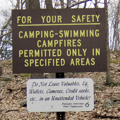
| The parking area on County Route 106 (March 2011). | ||
 |
||
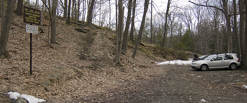
| The parking area. The White Bar trail, where you will begin the hike, is the trail going diagonally up the hill to the right of the signs. (March 2011) | ||
 |
||
 |
 |
|
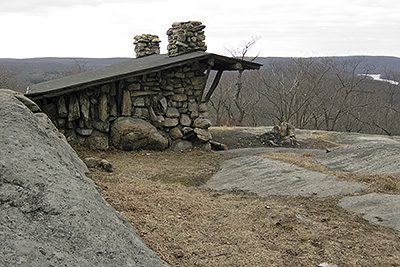
| The Tom Jones Shelter is just east of the RD and north of the RD's intersection with the Victory trail. (March 2011) | ||
 |
 |
|
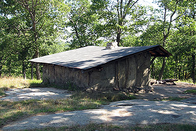
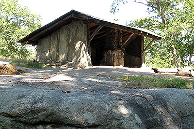
| The Bald Rocks Shelter is east of the Ramapo Dunderberg trail, just south of where the RD intersects with the Dunning trail. (September 2008) | ||
 |
||
| Elevation profile | ||
Last updated: 3/2011