|
|
WARNING/DISCLAIMER: Hiking can be dangerous and the information furnished below may contain errors! |
Doodletown Plus West Mountain
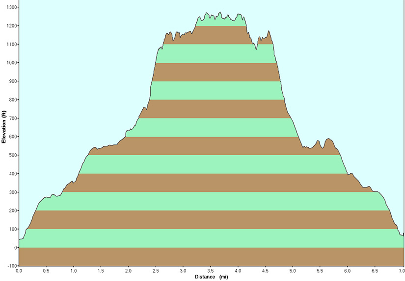
Total Distance: 7 miles
Difficulty: medium+ (1330’+ total elevation gain)
Estimated hiking time: 4.5+ hours (individual)
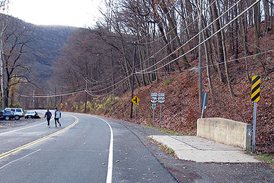
Across the road and about 100’ north of the northern end of the parking area and opposite a sign for Iona Island is the Cornell Mine trail (blue blazes). A sign for Doodletown may also be present here. Go right (north) on this trail for a very short while until you reach a (partially paved) woods road. Continue onto and stay on the road after the Cornell Mine trail goes off to the right. The road will soon merge with 1777E trail (marked with circular white discs with the trail's name on it in red). Continue straight on the road (and the 1777E trail).
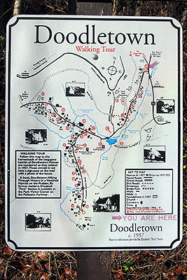
At some point there will be a fork in the road with a sign saying that the "Herbert Cemetery" is to the left and that "Historic Sites" are to both the left and the right. Take the left fork (towards the "Herbert Cemetery). In about 100 yards you will reach an intersection with the 1777 and the 1777W trails. It is not a well marked intersection from the direction that you will be traveling so look carefully (on the right!). All of the 1777 trails have similar markings albeit with slightly different trail names (check the trail markers carefully). Make a right onto the 1777W trail (did I say that this is not a well marked intersection!?) and take it until you reach the Appalachian Trail ("AT", white blazes).
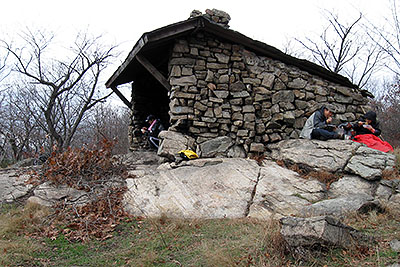
Make a left onto the Appalachian Trail. The Timp-Torne trail (TT, blue blazes) will merge in from the right. Continue south on the merge trail until the TT splits off to the left. Take the TT trail at this point until you reach the Suffern-Bear Mountain trail (S-BM, yellow blazes). Walk on the combined TT/S-BM trails for about 0.3 miles. When they split continue a little further on the TT trail until you reach the West Mountain Shelter. Enjoy the view here and then reverse direction on the TT trail. Make a right onto the Suffern-Bear Mountain trail (do not take the combined TT/S-BM you had taken before) . Take the S-BM north until you intersect the 1777W.
Make a right onto the 1777W trail when you reach it (a very poorly marked intersection which comes just before a dirt/grassy road) and later make a left onto the 1777E trail (and the road that you were on earlier). Take the road back to where you started the hike (retracing your steps on the road to where you started the hike).
REFERENCES: New York - New Jersey Trail Conference Map #119 (Harriman Bear Mountain Trails)
Driving Directions from New York City
From NYC take the George Washington Bridge to the Palisades Interstate Parkway (going north). Take the Palisades Interstate Parkway for about 40 miles until its end at the traffic circle just before Bear Mountain Bridge.
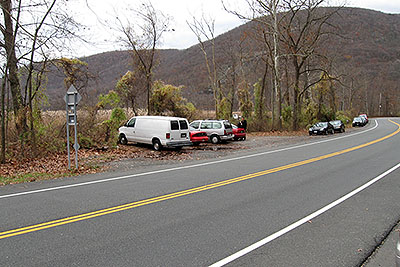
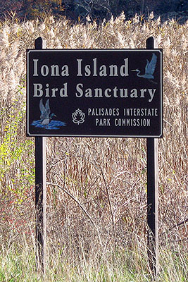
At the traffic circle make a right onto Route 9W South and Route 9W south for approximately 1.5 miles (it is approximately 1.25 mile south of the Bear Mountain Inn) and park in the small parking area on the north bound (left) side of the road (GPS: N 41.30060, W 73.98596). There are various signs for Iona Island about 100’ south and also about 100’ north of the parking area.
Driving distance is about 46+ miles and the total driving time is estimated at under one hour without traffic.
Public Transportation
From the Port Authority in New York City there is a bus that leaves people off upon request(!) in front of the Iona Island sign (after getting left off, walk a couple of hundred feet north to find the parking area. If you miss this stop then in about 1.25 miles you will be at the Bear Mountain Inn.
Click here for What to Bring on a Hike
Click here for Information for Group Hikes
Questions: Michael Brochstein
 |
 |
|
| The parking area (November 2008). | The parking area, on the left (November 2008). | |
 |
 |
|
| The parking area, on the left (November 2008). | Signs opposite the parking area (November 2008). | |
 |
 |
|
| Sign for Iona Island found about 100 feet south of the parking area (November 2008). | Sign for Iona Island found about 100 feet south of the parking area (November 2008).. | |
 |
 |
|
| The start of the hike. A blue trail blaze for the Cornell Mine trail is found here (on the slim plastic brown stake in the ground slightly to the left of center in the above photo) (November 2008). | Sign for Iona Island found about 100 feet north of the parking area (November 2008). | |
 |
 |
|
| Signs at the start of the hike (November 2008). | Detail of sign found at the start of the hike (November 2008). | |
 |
 |
|
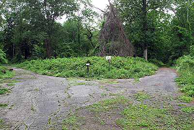
| Towards the beginning of the hike (when the 1777E trail coincides with the road) you will be walking on the road through Doodletown and get to this fork in the road (the sign at the fork is shown at right). Take the left fork (towards Herbert cemetery as indicated on the sign) and within about 100 yards is the (not well marked from the direction you'll be walking) 1777W trail which you will make a right onto. (June 2009) | Close-up of sign shown in the photo at left. When first encountering this sign at a fork in the road towards the beginning of the hike you will take the left fork (towards Herbert cemetery as indicated above). The fork in the road is pictured at left. (June 2009) | |
 |
 |
|
| One of the signs in Doodletown that you will see (November 2008). | The trail marker for the 1777W trail. The markers for the 1777 and 1777E trails are extremely similar albeit without the "W") (November 2008). | |
 |
 |
|
| The West Mountain Shelter (November 2008). | The West Mountain Shelter with the Hudson River in the background (November 2008). | |
 |
||
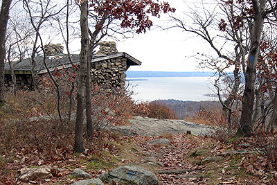
| The Timp and the Hudson River as seen from the West Mountain Shelter area (November 2008). | ||
 |
||
Last updated: 7/2010
Copyright © 2009-2010 Michael Brochstein. All rights reserved.