|
|
WARNING/DISCLAIMER: Hiking can be dangerous and the information furnished below may contain errors! |
Dover Oak & Nuclear Lake
Distance:
7 miles roundtrip (7.5 with optional part below)This hike is entirely on the Appalachian Trail (AT, white blazes) and is out-and-back on the same trail. Cross the road from the Dover Oak and hike into the woods on the AT. You will be heading westward (south on the AT). In about 0.7 miles a side trail on the left heads towards a shelter, continue straight on the A.T. In another 0.2 miles a 100 foot side trail to the right leads to a rocky ledge ("Cat Rocks") with a great view.
Continue on the AT in the direction you were going until you reach Nuclear Lake. When you reach the intersection of the AT and the yellow blazed loop trail continue for about 0.5 miles on the AT until a grassy area abutting the lake (near the end of a road). Eat lunch here and then retrace your steps northbound on the AT to return to where you began the hike.
Optional: When, upon reaching Nuclear Lake and you reach the intersection of the AT and the yellow blazed loop trail, take the loop trail to the left around to the its end where it meets the AT. Make a right (to go northbound) onto the AT until the lunch spot described above (the lunch spot is not the fenced in area, it is northeast of this fenced in area). After lunch complete the loop, and retrace your steps northward on the AT back to where you began the hike. This option adds about a half mile to the hike.
References:
Appalachian Trail Guide - New York-New Jersey, map set #1&2Driving Directions from NYC
West Side Highway/Henry Hudson Parkway North into the Saw Mill River Parkway North to its end where it joins up with Route 684 North. Take Route 684 north to its end where it joins up with Route 22 North. Take Route 22 north towards Pawling.
About one mile north of Pawling Trinity School make a left onto River Road. Take River Road for about 0.8 miles (until it ends) and then make a right onto West Dover Road / County Road 20. Take West Dover Road / County Road 20 for about 1.5 miles until you get to the Dover Oak (a huge oak tree on your right). Park here (GPS: N 41.60293, W: 73.61147) in one of the few parking spaces available on the shoulder (do not park on the road or block the road, park offroad on the shoulder). The entire drive is about 71 miles and takes about 80 minutes.
Click here for What to Bring on a Hike
Click here for Information for Group Hikes
Questions: Michael Brochstein
|
|
 |
|
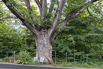
| The parking area by the Dover oak. (August 2012) | The Dover Oak, 300+ years old and about 22 feet in circumference, is the largest oak tree on the Appalachian Trail. (July 2011) | |
 |
 |
|
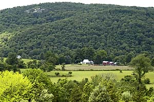
| The rocky outcropping ("Cat Rocks") in the upper left of the photo is the viewpoint atop West Mountain. (July 2003) | The West Mountain rock outcropping (recommended lunch spot). (July 2003) | |
 |
 |
|
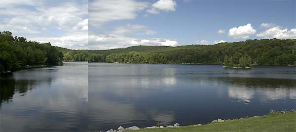
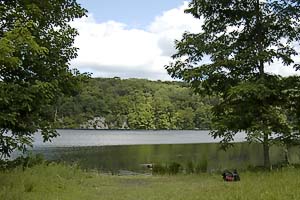
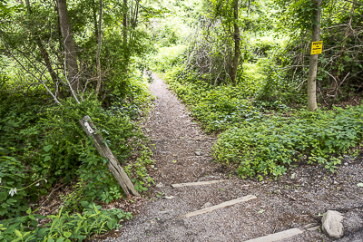
| The lunch spot by Nuclear Lake. (July 2003) | The start / end of the hike (June 2015) | |
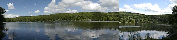
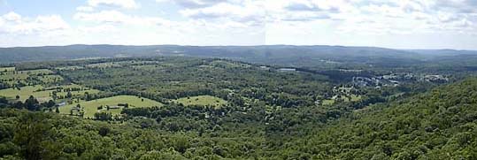 A part of the of the panoramic view from the rocky outcropping atop West Mountain. (July 2003) |
||
|
|
||
|
|
||
|
|
||
| Elevation profile (August 2012). | ||
|
|
||
| Elevation profile for version with optional extra (August 2012). | ||
Last updated: 2/2016