|
|
WARNING/DISCLAIMER: Hiking can be dangerous and the information furnished below may contain errors! |
Johnsontown Road - Lake Sebago Circular
Total Distance: 7 miles
Difficulty: moderate (800'+ total elevation gain)
Estimated hiking time: 4+ hours
The Blue Disc trail (blue blazes, could be better marked at key points!) starts from the north side of the road just before the parking circle. Take the Blue Disc trail (initially a paved road, then gravel, then a regular trail) west and then north until you intersect the Tuxedo-Mount Ivy trail (TMI, red blazes). Make a right onto the TMI. The TMI merges with the White Bar trail (white blazes) for a short while and the Dutch Doctor Shelter (a little north on the White Bar Trail) may be seen from the TMI when you first intersect the White Bar trail. Stay on the TMI. On the TMI there is a flat rocky area slightly off-trail at the southern end of Lake Sebago not far before you reach Seven Lakes Drive that makes for a nice lakeside lunch spot. Take the TMI until you reach the Hillburn-Torne Sebago trail (HTS, orange blazes) on your right.
Make a right onto the HTS. In about one-tenth of a mile you will meet the Stony Brook trail (yellow blazes). Go straight onto the Stony Brook trail (the the HTS turns left here). The Stony Brook trail will merge with the Kakiat trail (white blazes) for a while. Make a right to stay on the Kakiat trail when the two trails split (the Stony Brook trail goes straight at this point). Take the Kakiat trail until you intersect the White Bar trail (white blazes). Make a left onto the White Bar trail and take it back to the parking lot.
References: New York-New Jersey Trail Conference Map #118 (Southern Harriman Bear Mountain Trails)
Driving Directions from New York City
Take the George Washington Bridge to the Palisades Interstate Parkway heading north. In about 19 miles exit the parkway at exit 9W onto the Thruway (Route 87/287) which heads west. About 10 miles later, exit the Thruway at exit 15A. At the exit turn left onto Route 17 North. After about 2.5 miles, just north of the main street area in Sloatsburg, make a right onto Seven Lakes Drive.
In a little more than half a mile make a left turn onto Johnsontown Road. There are actually two places to turn left from Seven Lakes Drive on to Johnsontown Road, either one is fine. If you make the first possible left turn then proceed straight after the turn (to the circular dead end). If you miss the first opportunity to turn left then take the second and then make a right at the "T" which you will shortly come to. In a little over a mile until you reach a circular dead end where you should park (N 41.18003, W 74.16350). The entire trip is about 41 miles and should take less than an hour.
Public Transportation
N/A
Click here for What to Bring on a Hike
Click here for Information for Group Hikes
 |
 |
|
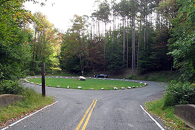
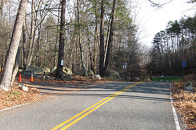
| The circular dead-end of Johnsontown Road (park here). The hike finishes with the White Bar trail located on the far side of the circle. (September 2009) | The hike (and the Blue Disc trail) starts on the left just before the parking area at the far end of the road. (November 2009) | |
 |
 |
|
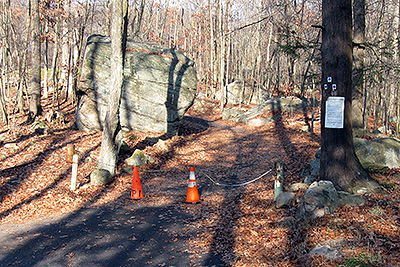
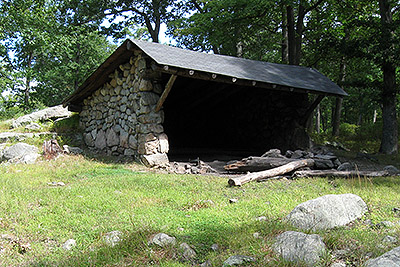
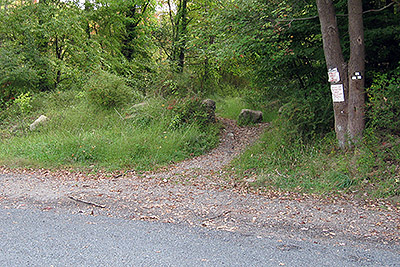
| The beginning of the Blue Disc trail and the start of the hike, note the three trail markers on the tree at right in a triangular formation. (November 2009) | The Dutch Doctor Shelter located on the White Bar trail just north of its intersection with the Tuxedo-Mount Ivy trail. (September 2009) | |
 |
||
| The trail head for the White Bar trail is above (where you'll be at the end of the hike). Note the three white blazes in a triangular pattern on the tree at right. These blazes signify the start/end of the White Bar trail. (September 2009) | ||
 |
||
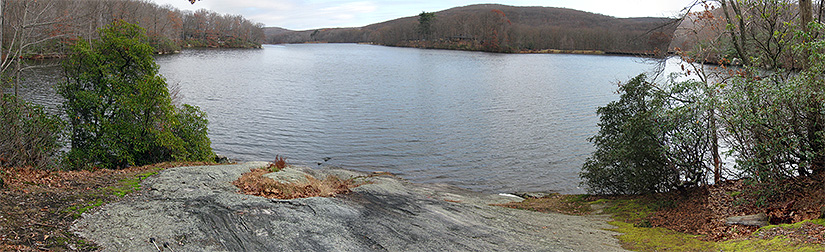
| Lake Sebago, at the recommended lunch spot. (November 2009) | ||
 |
||
Questions: Michael Brochstein
Last updated: 11/2009