|
|
WARNING/DISCLAIMER: Hiking can be dangerous and the information furnished below may contain errors! |
Mt. Taurus Hike
Total Distance: 5.2 miles
Difficulty: medium - strenuous (strenuous 1400' rise)
Estimated hiking time:
3.5+ hours (individual), 4+ hours (group)
Hiking Notes
Take the Washburn trail (white blazes) until the top of Mt. Taurus (a.k.a. Bull Hill). The various overlooks on top make for nice (albeit early) lunch spots. Continue straight on the Washburn trail (passing the yellow Undercliff trail) until it intersects with the Notch trail (blue blazes). Continue straight onto the the Notch trail (do not go right onto the green Lone Star trail). Please note that the markings on the Notch trail could be better so please pay attention.
Make a left onto the Brook trail (red blazes) and take it (passing the yellow Undercliff trail) until you meet the Cornish trail (blue blazes). Continue straight onto the Cornish trail (blue blazes) when the Brook trail goes right. For a while the Cornish trail will be paved and will eventually bring you very close to a gate by the road. At this point the trail will turn left to continue on an unpaved section. The Cornish trail could also be better marked! Take the Cornish trail back to the parking area.
REFERENCES: NY-NJTC Map #102 (East Hudson Trails - 2006 / seventh edition)
Driving Directions from NYC
From NYC take the George Washington Bridge to the Palisades Interstate Parkway (going north). Take the Palisades Interstate Parkway for about 40 miles until its end at the Bear Mountain Bridge. Cross the Bear Mountain Bridge and make a left onto Route 9D (north).
Take Route 9D north for about 9.5 miles passing through the town of Cold Spring. Park on the side of the road near the Washburn Trail (white blazes on the right hand side of the road) about 0.7 miles north of the intersection of NY 9D and NY 301 in Cold Spring (GPS: N 41.42669, W 073.96547). If you drive through an underpass you have gone too far.
The total driving time is estimated at one hour without traffic.
Public Transportation
Metro-North Railroad's Hudson Valley line stops in the town of Cold Spring (212/532-4900 or 800/638-7646).
Click here for What to Bring on a Hike
Click here for Information for Group Hikes
Questions: Michael Brochstein
 |
 |
|
| The parking area on the north bound side of Route 9D next to the trail head. (October 2001) | The parking area on the south bound side of Route 9D opposite the trail head parking area. (October 2001) | |
|
|
||
|
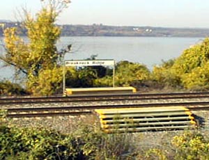
The Metro North "Breakneck Ridge" train stop about 2 miles north of the trailhead. (October 2001) |
||
 |
 |
|
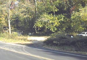
| The Washburn trailhead. (October 2001) | ||
 |
||
| Elevation profile for hike. | ||
 |
 |
|
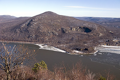
| View from across the Hudson River of Breakneck Ridge (January 2009). | View from across the Hudson River of Mount Taurus (January 2009). | |
 |
||
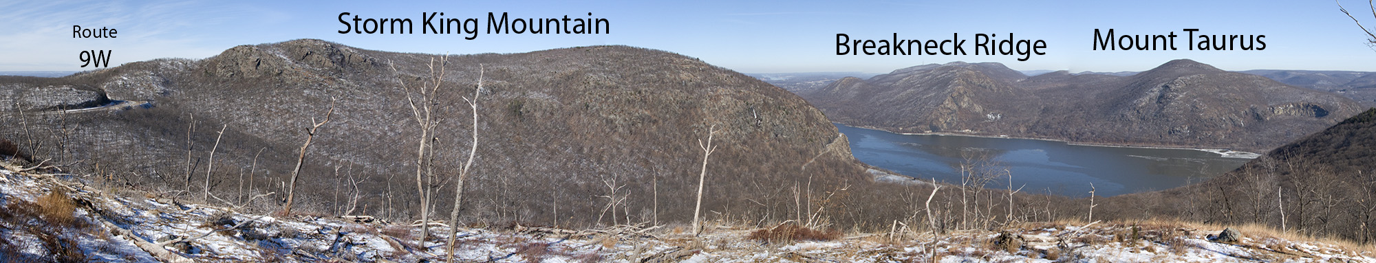
| View from "North Point" (on the Howell Trail) looking northward with Route 9W on the left, Storm King Mountain to the north and Breakneck Ridge and Mount Taurus on the right, across the Hudson River - click on image to see an even bigger version (January 2009). | ||
Last updated: 1/2009