|
|
WARNING/DISCLAIMER: Hiking can be dangerous and the information furnished below may contain errors! |
Palisades Interstate Park: Southern Section Hike
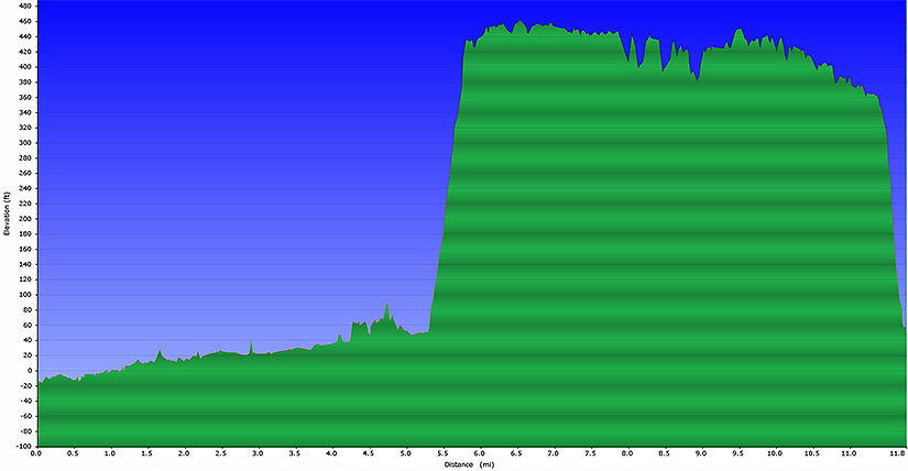
Length: 11.8 miles
Difficulty:
moderate (650’+ total elevation gain)
Estimated hiking time:
5+ hours
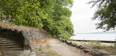
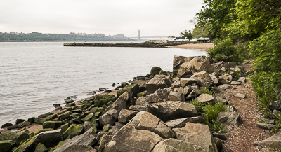
Take the Shore Trail (white blazes) north
(water on your right) from the north end of the marina / parking area located
at the Englewood Boat Basin marina north to the parking area of the marina at
the Alpine Boat Basin (near exit 2). The trail is not always well marked and
typically runs within a few yards of the shoreline (and in certain conditions
could be underwater necessitating a detour).
Continue on the Shore
trail. Just beyond (northern end of) the parking area for the Alpine Boat
Basin marina you will intersect the Closter Dock trail (orange blazes)
on your left. Take it up until you intersect the Long Path (blue blazes).
Make left onto the Long Path (which will for a
time coincide with the Closter Dock trail) and take it south
(water on your left) until you intersect the Dyckman Hill Trail
(yellow blazes). Make a left onto the Dyckman Hill trail and it down to the
parking area (where your car should be).
Reference:
NY-NJTC Trail Map #108 (Hudson Palisades Trails)
Driving directions to Palisades Interstate Park
Take the George Washington Bridge to the Palisades Interstate Highway North. Exit at Exit 1 and take the road down towards the water to the marina where there is a parking lot. Pay the (in-season) parking fee and park in the parking lot (GPS: N 40.87567, W 073.94672). Driving distance is about 9 (nine) miles and the total driving time is estimated at about 20 or so minutes without traffic.
Click here for What to Bring on a Hike
Click here for Information for Group Hikes
Questions: Michael Brochstein
 |
 |
|
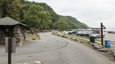
| Parking area (May 2015) | Start of the hike (head north along the shore, not up the stairs) (May 2015) | |
 |
 |
|
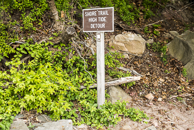
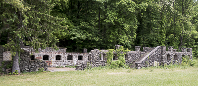
| Occasionally you may have to detour as the Shore trail could be underwater (May 2015) | A "ruin" along the Shore trail (May 2015) | |
 |
 |
|
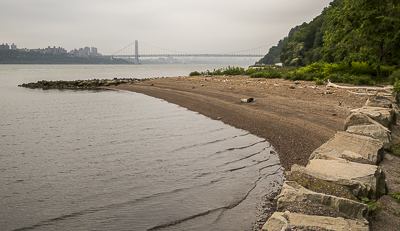
| Along the shore trail, the George Washington Bridge is in the background. (May 2015) | Along the shore trail, the George Washington Bridge is in the background. (May 2015) | |
 |
 |
|
| The continuation of the Shore trail at the northern end of the Alpine Boat Basin marina (May 2015) | Sign near the northern end of the Alpine Boat Basin marina (May 2015) | |
 |
 |
|
| The start of the Closter Dock trail, note the orange blazes at the top right of the image (May 2015) | The Closter Dock trail and Long Path coincide here, note both color blazes on the right side of the underpass (May 2015) | |
 |
 |
|
| A view along the Long Path (May 2015) | A view along the Long Path (May 2015) | |
 |
 |
|
| A view along the Long Path (May 2015) | A view along the Long Path with the Henry Hudson Bridge on the other side of the river(May 2015) | |
 |
||
| Elevation profile | ||
Last updated: 5/.2015