|
|
WARNING/DISCLAIMER: Hiking can be dangerous and the information furnished below may contain errors! |
Hiking in Harriman State Park:
Total Distance: approximately 6 miles
Difficulty: Medium (medium hills,
1200'+ total climbing)
Estimated hiking time: 4+ hours (group)
Take the Ramapo-Dunderberg Trail (RD, red blazes) which starts just south of the parking area on the far side of the railroad tracks. (See note about Weekends in the driving directions section for new information about where to find the RD trail from the parking lot). Continue on the RD trail as it passes the terminus of the Tuxedo-Mt. Ivy (TMI, red blazes) trail on the right.
At the 3-way intersection of the RD, the Victory Trail (blue blazes) and the Blue Disc (blue blazes) trail make a right onto the Blue Disc trail (blue blazes). Take the Blue Disc trail south past its intersection with the TMI.
Eat lunch on top of Dater Mountain viewpoint (where the "Reeves Meadow Visitor Center" is visible in the distance). Continue south on the Blue Disc trail until it intersects the Kakiat Trail (white blazes). Make a right onto the Kakiat Trail and take it back to the trailhead and then back to the parking area (the same way you walked from the parking area to the trailhead).Note: As of April 2007 the Blue Disc trail south of the Claudius Smith Den area has some blazes which seem to have been spray painted brown in an effort to obscure them. The trail can still be followed if you pay attention.
References: NY-NJTC Trail Map #3 (Harriman Bear Mtn. Trails)
Driving Directions from New York City
Take the
George Washington Bridge to the Palisades Interstate Highway heading North.In about 19 miles exit the parkway at exit 9W onto the Thruway (Route 87/287) which heads west.
About 10 miles later, exit the Thruway at exit 15A. At the exit turn left onto Route 17 North.
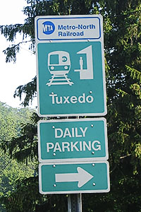
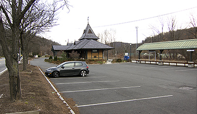
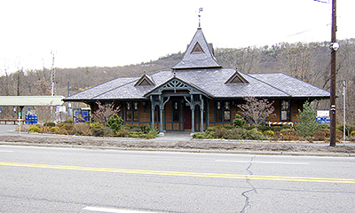
After about 4.9 miles you will see the Tuxedo (Park) Train and Police Stations on your right. Park here (N 41.19376, W 074.18453).
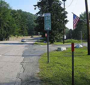
On Weekends - Free weekend parking is available in the metered commuter parking lot. Make a right (onto East Village Road) just north of the train station lot and cross the railroad tracks until you get to the large lot on your left (There will be signs after you cross the tracks). The RD trail has been rerouted to start from this parking lot.
The entire trip is about 41.4 miles and should take less than an hour.
Public Transportation from New York City
As of April 2006: From the Port Authority in New York City take the Short Line bus (212/736-4700) that leaves at 7:50am from (the North Wing?) of Port Authority. This but will arrive at 8:52am in Tuxedo, NY (on Route 17) in front of a parking lot near the railroad / police station. This information is also known as AMC Transportation code #1C.
Click here for What to Bring on a Hike
Click here for Information for Group Hikes
Questions: Michael Brochstein
 |
 |
|
| The Tuxedo Train Station (November 2012) | ||
|
|
 |
|
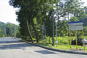
| Detail of sign directing one to the weekend parking area. (June 2006) | On weekends make a right north of the train station onto East Village Road to get to the free weekend parking area. (June 2006) | |
 |
 |
|
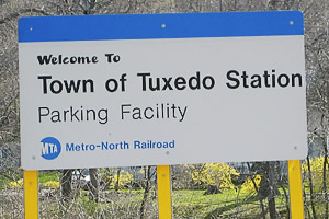
| Entrance to weekend parking area. (June 2006) | Sign for parking lot to be used on weekends. (April 2006) | |
 |
 |
|
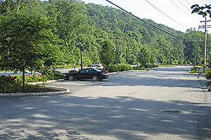
| Weekend parking area. (June 2006) | From the lunch spot you will see in the distance the Reeves Meadow Visitor Center and Seven Lakes Drive. (July 2007) | |
 |
 |
|
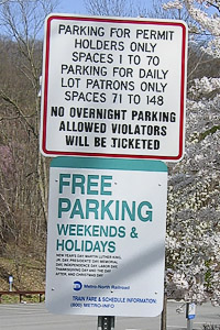
| Sign denoting free weekend parking in the metered commuter parking lot. (April 2006) |
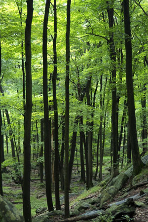
(August 2003) |
|
 |
||
|
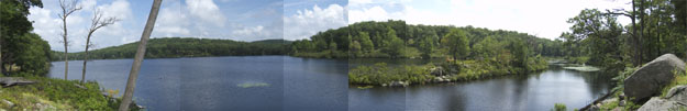
Lake Skenonto (August 2003) |
||
 |
||
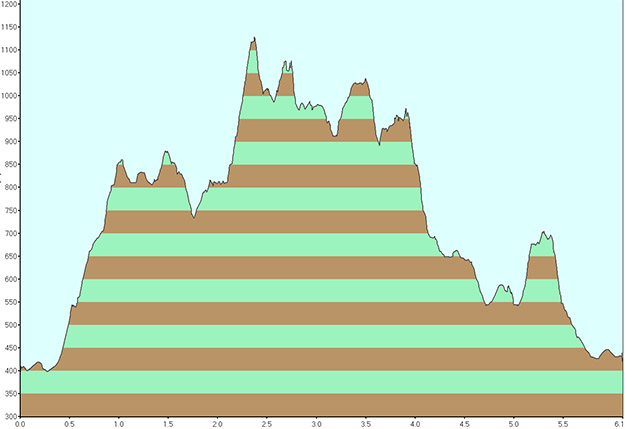
| Elevation profile for hike. | ||
Last updated: 7/2007