|
|
WARNING/DISCLAIMER: Hiking can be dangerous and the information furnished below may contain errors! |
Hiking in Harriman State Park:
Total Distance: 8 miles (1,500+ feet
of elevation gain)
Difficulty: Medium+ (medium hills)
Estimated hiking time: 5.5-6 hours (group)
Take the Ramapo-Dunderberg trail (RD, red dot on white background blazes) which starts just south of the parking area on the far side of the railroad tracks. Continue on the RD trail as it passes the terminus of the Tuxedo-Mt. Ivy (red blazes) trail on the right and the White Cross trail.
Make a right onto the Triangle trail (yellow blazes). At Lake Skenonto eat lunch and then take the Victory Trail (blue "V" in a white blaze) south until the Blue Disc trail (blue circles on white blazes).
Make left onto the Blue Disc trail take it until the Claudius Smith Den overlook. Soon after the overlook make a right onto the Tuxedo-Mt. Ivy trail (TMI, red blazes). Take the TMI until its terminus and then make a left onto the RD trail and take this back to the parking area.
On Weekends - The Ramapo-Dunderberg trail has been rerouted to start from the metered commuter parking lot (see below under Driving Directions).
References: References: NY-NJTC Trail Map #118 (Harriman Bear Mtn. Trails)
Driving Directions from New York City
Take the
George Washington Bridge to the Palisades Interstate Highway heading North.In about 19 miles exit the parkway at exit 9W onto the Thruway (Route 87/287) which heads west.
About 10 miles later, exit the Thruway at exit 15A. At the exit turn left onto Route 17 North.
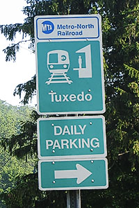
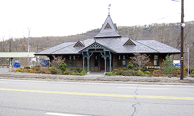
After about 4.9 miles you will see the Tuxedo (Park) Train and Police Stations on your right. Park here (N 41.19376, W 074.18453).
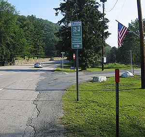
On Weekends - Free weekend parking is available in the metered commuter parking lot. Make a right (onto East Village Road) just north of the train station lot and cross the railroad tracks until you get to the large lot on your left (There will be signs after you cross the tracks). The RD trail has been rerouted to start from this parking lot.
The entire trip is about 41.4 miles and should take less than an hour.
Public Transportation from New York City
As of October 2008: From the Port Authority in New York City take the Short Line (212/736-4700) bus # 401 that leaves at 8:30am from (the North Wing?) of Port Authority. This bus will arrive at about 9:17am in Tuxedo, NY (on Route 17) in front of the bus shelter by a parking lot near the railroad / police station. The stop you need is by request only so be sure to tell the bus driver that you wish to get off by the bus shelter in Tuxedo which is by the railroad / police station in the center of town. From the bus shelter walk a short distance north until East Village Road. Make a right and then diagonally on your left will be a commuter parking lot where drivers will be meeting. This parking lot is not visible from the spot where you will be getting off the bus. Please allow time to buy your ticket in the Port Authority before going to the gate where you will meet the bus. I recommend checking with Shortline to be sure that the schedule has not changed. This same bus is popular with hikers on weekends and it is not at all uncommon to see other hikers going to Tuxedo as well as to other destinations in the area. Please do not assume they are going to the same destination that you are going to. This information is also known as AMC Transportation code #1C. FYI, there are also other Shortline buses that go from the Port Authority to Tuxedo, NY every day.
Click here for What to Bring on a Hike
Click here for Information for Group Hikes
Questions: Michael Brochstein
 |
 |
|
| The Tuxedo Train Station (November 2012) | ||
|
|
 |
|
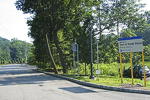
| Detail of sign directing one to the weekend parking area. (June 2006) | On weekends make a right north of the train station onto East Village Road to get to the free weekend parking area. (June 2006) | |
 |
 |
|
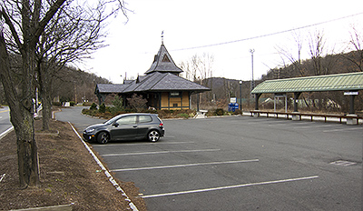
| Entrance to weekend parking area. (June 2006) | Sign for parking lot to be used on weekends. (April 2006) | |
 |
 |
|
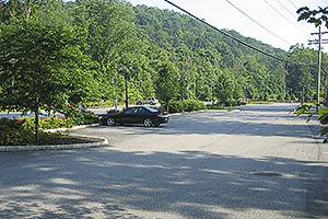
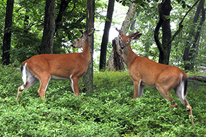
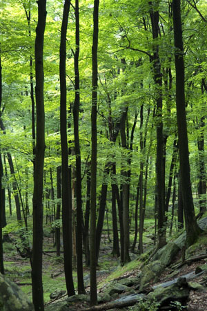
| Weekend parking area. (June 2006) | We share the woods,... (July 2008). | |
 |
 |
|
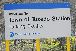
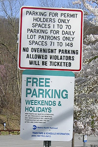
| Sign denoting free weekend parking in the metered commuter parking lot. (April 2006) |
(August 2003) |
|
 |
||
|
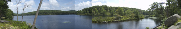
Lake Skenonto (August 2003) |
||
 |
||
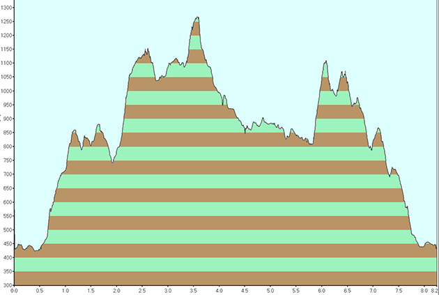
| Lake Skenonto hike elevation profile. | ||
Last updated: 10/2008