|
|
WARNING/DISCLAIMER: Hiking can be dangerous and the information furnished below may contain errors! |
Wayne's Timp Hike
Total Distance: approximately 8+ miles
Difficulty: medium - difficult (hilly/steep/rocky terrain)
Estimated hiking time: 5+ hours - individual, 6+ hours - group
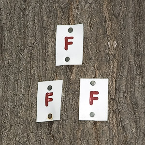
Take the Anthony Wayne trail (white blazes) from the north end of the parking lot north eastward until it intersects the Fawn Trail (red "F" on white blazes, on the right after a sharp left). Take the Fawn Trail until it intersects the Timp-Torne Trail (blue blazes). Make a right onto the Timp-Torne trail and take it until The Timp (eat lunch here). The T-T trail will at times coincide with other trails (but stay on the T-T trail).
Note: The after lunch part of this hike will probably take longer than the pre-lunch portion. My guess is a half hour longer.
After lunch continue on the Timp-Torne Trail until it intersects the Ramapo-Dunderberg trail (red dot on white blazes) and make a sharp right onto it. Do not take the trail which has a circular white blaze with a red circle around it and a red cross bisecting it. The RD is not always well marked and will at times coincide with other trails (but stay on the RD trail).
Take the R-D trail until it intersects Beechy Bottom Road. Make a right onto it. At a three way intersection with another road, make a left onto this road and after a short while veer right on the road towards some buildings. Eventually the parking lot will come into view on the left. Your car should be at the far (north) end of it.
REFERENCES: NY-NJTC Map #4 (Northern Harriman Bear Mountain Trails)
Driving Directions from NYC
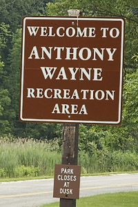
From NYC take the George Washington Bridge to the Palisades Interstate Parkway (going north). Take the Palisades Interstate Parkway north until Exit 17. Exit at Exit 17 and enter the Anthony Wayne Recreation Area. Park in the north end of the very large (northern) parking lot, the one on the immediate right after entering the Anthony Wayne Recreation Area (GPS: N 41.29803, W 074.02764).
The total driving distance is estimated at about 41.5 miles and should take under one hour without traffic.
Click here for What to Bring on a Hike
Click here for Information for Group Hikes
Questions: Michael Brochstein
 |
 |
|
|
Entrance to Anthony Wayne Recreation
Area. The booth on the right |
||
 |
 |
|
| Part of the large parking field. (June 2005) |
Fawn Trail blaze. (June 2005) |
|
 |
 |
|
|
Gate north of the parking field where hike starts (detail of sign on gate shown at right). You should park at the north end of the parking field closest to this gate. (June 2005) |
||
 |
||
| Beechy Bottom Road. (June 2005) | ||
 |
||
| One of the many fine views seen during this hike. (June 2005) | ||
 |
||
|
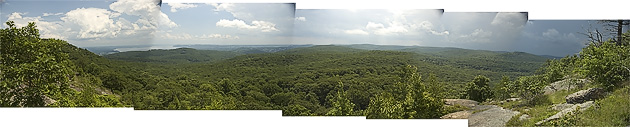
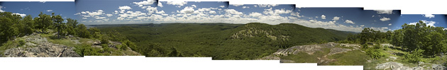
270 degree panoramic view from "The Timp". New York City's skyline can be discerned in the distance on a clear day. (June 2004) |
||
Last updated: 6/2005