|
|
WARNING/DISCLAIMER: Hiking can be dangerous and the information furnished below may contain errors! |
West Pawling, New York Appalachian Trail Highlights
Distance: 7.2 miles
Time: 4 - 5 hours - group
Difficulty: moderate (small rolling hills)
From the parking area head eastward into the forest on a blue blazed access trail (the only one that is at the parking area). Take this trail for a short distance until you intersect the Appalachian Trail (AT, white blazes). Turn left onto the AT. After a short distance you will reach the beginning of the Beekman Uplands Trail (blue blazes). Veer left onto the Beekman Uplands trail (leaving the AT). At the end of the Beekman trail, when it again meets the Appalachian trail, veer left (eastward) onto the AT.
In about 1.5 miles take a very short side trail (on the left) to the rocky outcropping ("Cat Rocks") with a great view of the valley. Eat lunch here. After lunch reverse course on the AT and take it until you reach Nuclear Lake in about 2+ miles. Follow the AT around Nuclear Lake.
There should be a fairly open grassy (or somewhat tall grass?) field on your left (the second one, this one has good / open access to the lake) which has a large unobstructed area by the shoreline. It is opposite where the AT heads into the woods (on your right). Have your dessert here by the shore. Opposite this grassy area, the AT continues westward into the woods (don't continue on unpaved roadway). Take the AT until you reach the Beekman trail intersection again. Continue on the AT a short way until you reach the blue blazed access trail and take this blue trail to get back to your car.
References: Appalachian Trail Guide - New York-New Jersey, map set #1&2
Driving Directions from NYC
West Side Highway/Henry Hudson Parkway North into the Saw Mill River Parkway North to its end where it joins up with Route 684 North. Take Route 684 north to its end where it joins up with Route 22 North. Take Route 22 North towards Pawling for approximately 11 or 12 miles.
Take the right hand exit to get onto onto Route 55 West (towards Poughkeepsie). After about 5.6 miles on Route 55 park at the small parking area on the right (soon after intersecting the Appalachian Trail). There may be a store directly across the road from the parking area. The blue blazed trailhead will be visible from the parking area. (GPS: N 41.35392, W73.39545).
The total driving distance is about 69 miles and should take no longer than 1.5 hours under normal traffic conditions.
Public Transportation
None for this hike exactly but a similar hike covering a lot of the same places does have public transportation available.
Click here for What to Bring on a Hike
Click here for Information for Group Hikes
Questions: Michael Brochstein
 |
 |
|
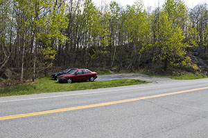
| The parking area (April 2008). | Store opposite parking area (April 2008). | |
 |
 |
|
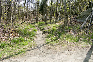
| Beginning of blue access trail from parking area (April 2008). | Sign in front of store opposite parking area (April 2008). | |
 |
 |
|
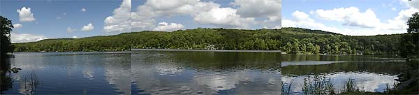
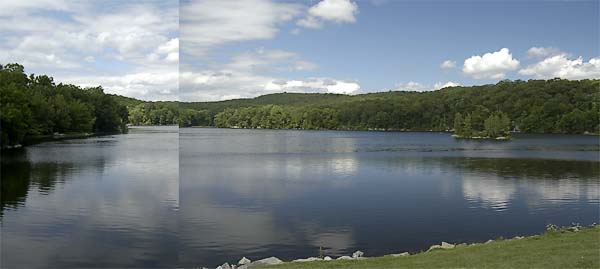
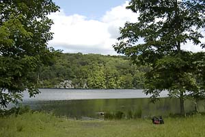
| A reminder about Lyme Disease (April 2008). | The lunch/dessert spot by Nuclear Lake. (July 2003) | |
 |
 |
|
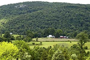
| The rocky outcropping in the upper left of the photo is the viewpoint atop West Mountain. (July 2003) | The West Mountain rock outcropping - recommended lunch spot. (July 2003) | |
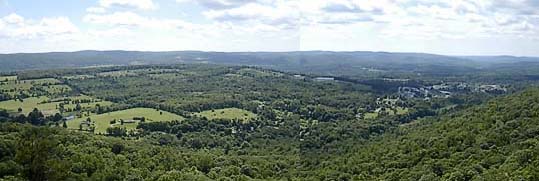 A part of the of the panoramic view from the rocky outcropping atop West Mountain. (July 2003) |
||
|
|
||
|
|
||
 |
||
Last updated: 8/2009