|
|
WARNING/DISCLAIMER: Hiking can be dangerous and the information furnished below may contain errors! |
Wyanokie High Point Hike
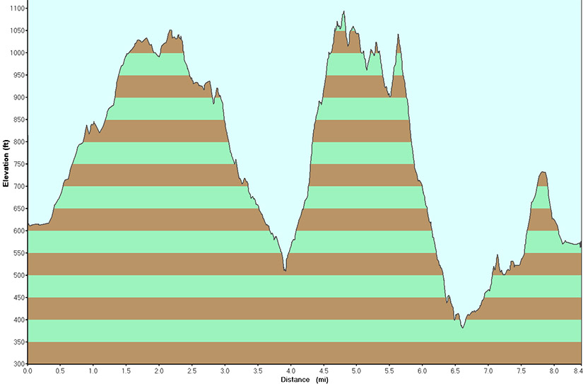
Total Distance: 8.4 miles
Difficulty: medium+ (hilly, about 1,000' elevation gain)
Estimated hiking time: 5+ hours -> 6.5+ (groups)
Starting at far end of the parking area, at the main road heading into the Weis Ecology Center property, take the Otter Hole Trail (OH, medium/light green blazes).
At some point the Highlands Trail (blue diamond) will merge. Follow the combined Otter Hole / Highlands tail until the Otter Hole trail ends. Continue to follow the Highlands trail, now coinciding with the Hewitt-Butler trail (HB, blue blazes) trail. When you reach the Post Brook Trail (PB, white blazes) make a right onto it and take it about a quarter-mile until Chikahoki Falls on your right. (This is a nice spot to have a snack). Retrace your steps back to the Hewitt-Butler trail and make a right onto it.
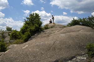
At some point you will meet the red blazed Wyanokie Circular trail (WCI). Make a right onto the WCI trail (you will still be following the blue diamond Highlands Trail). At Wyanokie High Point, eat lunch!
Continue on the WCI trail (red blazes) down the far side of High Point. Make a left onto the Roomy Mine trail (orange blazes) and then make a right onto the Mine trail (yellow blazes). At the end of the Mine trail go straight onto the Otter Hole trail and take this back to Weis Ecology Center.
REFERENCES: NY-NJTC Map #115 (North Jersey Trails)
Driving Directions to the Weis Ecology Center
The trail head parking area is at the entrance to the Weis Ecology Center (973/835-2160).
From NYC take the George Washington Bridge to Route 80 West. Take Route 80 about 26+ miles to exit 43, exit at exit 43 then take exit 43B, the exit for Route 287 North (stay to the right after taking exit 43). Take Route 287 North for about 13 miles until exit 55 (Wanaque / Pompton Lakes) for Route 511.
Take Route 511 North. Route 511 is a tricky route and you must carefully watch for the Route 511 signs (signs for the Weis Ecology Center can also be followed). You will drive about 4 miles and be looking for West Brook Road (on the left). There may also be a sign for the Weis Ecology Center (follow Weis Ecology Center signs if in doubt). Turn left onto this road and bear left.
You are now looking for Snake Den Road which should be the second left after passing Stonetown Road (at the fork) on your right and Townsend Road on the left (just before Snake Den Road - the sign may be missing). Follow Snake Den Road (keeping to the left) until you come to the parking field (on the right) for the Weis Ecology Center. (Do not turn onto Dale Road.). Park in this field. The parking area (GPS: N 41.06989, W 074.32180) is about 2.7 miles from the left you made from Route 511 onto West Brook Road.
The total driving time is estimated at about 1.25 hours without traffic and is about 54 miles.
Click here for What to Bring on a Hike
Click here for Information for Group Hikes
Questions: Michael Brochstein
 |
 |
|
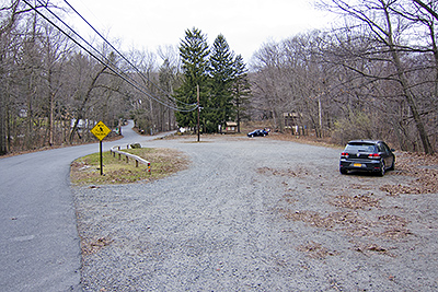
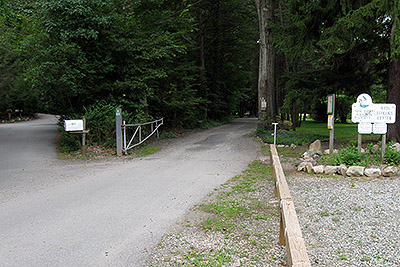
| The parking area on Snake Den Road for the Weis Ecology Center. (November 2012) | (November 2012) | |
 |
 |
|
|
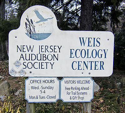
Weis Ecology Center. (November 2012) |
|
|
 |
 |
|
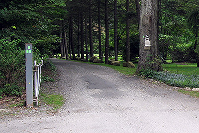
| The parking lot is on the right near the main entrance road to the Weis Ecology Center. The post with the three green blazes is where the hike starts. (August 2009) | The start of the Otter Hole trail (three green blazes in a triangular configuration) is shown on the post above on the left side of the photo. (August 2009) | |
 |
||
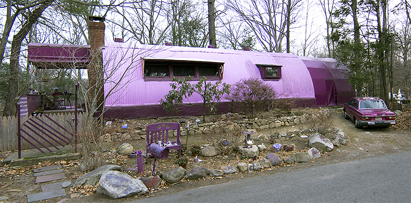
| A very purple and pink house & car on Snake Den Road. (November 2012) | ||
|
|
||
|
|
|
|
 |
 |
|
|
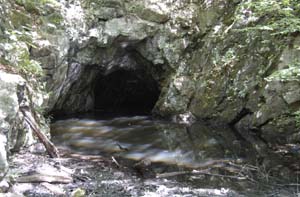
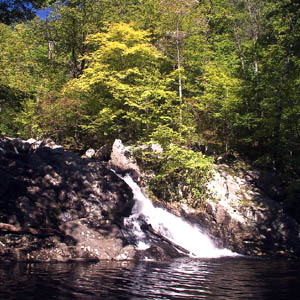
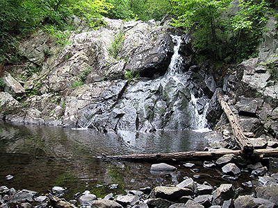
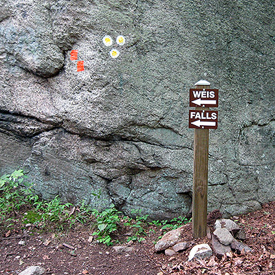
Chikahoki Falls |
Chikahoki Falls (August
2009) |
|
 |
 |
|
|
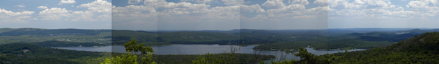
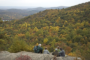
View from Wyanokie High Point (October 2004) |
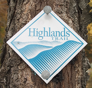
Highlands Trail blaze (October 2004, photo by Joel Miller |
|
 |
 |
|
| At the end of the WCI trail (red), after Wyanokie High Point, you will reach the end of the WCI trail and start to follow the Roomy Mine trail (orange). (August 2009) | ||
 |
||