|
|
WARNING/DISCLAIMER: Hiking can be dangerous and the information furnished below may contain errors! |
Southern Storm King State Park
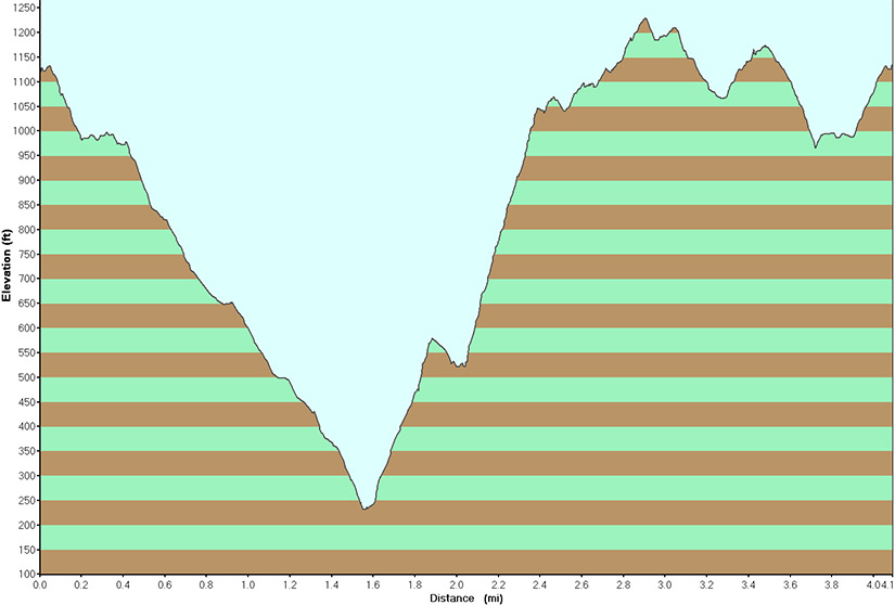
Total Distance: approximately 4 miles
Difficulty: medium (some hills, 1250' elevation gain)
Estimated hiking time: 3+ hours
From the northern end of the parking area take the Bobcat Trail (white blazes) for about 0.4 miles until its terminus where you will intersect the Howell Trail (blue blazes). Proceed straight (stay on the woods road) onto the Howell trail and take for about 0.4 miles until you intersect the Stillman Spring Trail (white blazes) on your right.
Make a right onto the Stillman Spring Trail and take it for about 0.7 miles until you reach end of the Stillman Spring trail at a parking area by Route 218 (the topo map may show this as Route 293). From the parking area, on your right, will be the start of the Howell Trail (blue blazes). The three blue blazes, in a triangular configuration denoting the trail's beginning, are slightly uphill from the parking area.
Take the Howell Trail. In a little while the trail will follow an old woods road for a while. After about 0.4 miles from the parking area on Route 218, when the trail turns sharply right, continue straight on the woods road (away from the Howell trail) a short while until you reach "Pitching Point". Now go back to the Howell trail and make a left onto it to continue in the direction you were previously heading. In about 1.7 miles you reach the intersection with the Bobcat Trail on your left. Make a left onto the Bobcat Trail and take it until you reach the parking area where your car is parked.
REFERENCES: NY-NJTC West Hudson Trails Map #113
Driving Directions from New York City
From NYC take the George Washington Bridge to the Palisades Interstate Parkway (going north). Take the Palisades Interstate Parkway for about 40 miles until its end where you pick up Route 9W North at a traffic circle just before the Bear Mountain Bridge (do not cross the Bear Mountain Bridge).
Take Route 9W North for about 8 miles until an unpaved parking area on the right. (GPS: N 41.41487, W 73.99364).
You have gone a little too far if you see another parking area on the right in another half-mile and later on either Mountain Road or Storm King School on your right.
The total driving distance is about 53 miles and the average driving time is estimated at 1 hour without traffic.
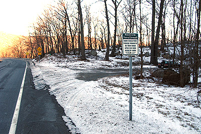
NOTE: There are a multiple of parking areas on the right (northbound side) in this part of Route 9W. Please make sure you are in the correct one. This parking area comes shortly before (south of) the parking area used for the Storm King Mountain hike. If you miss the parking area it is difficult to make a "U" turn in this section of Route 9W so I suggest driving slowly once you reach the vicinity of the parking area. The photo's below should (hopefully) help you figure out which is the correct parking area.
Public Transportation
N/A
Click here for What to Bring on a Hike
Click here for Information for Group Hikes
Questions: Michael Brochstein
 |
 |
|
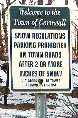
| Parking area with Route 9W North on the left (January 2009) | Sign just before parking area (January 2009) | |
 |
 |
|
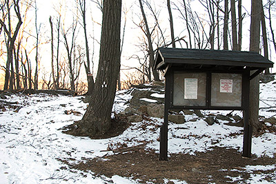
| Parking area as seen from Route 9W (January 2009) | Information sign board inside the parking area (on the north side of the parking area) and the 3-blaze trail blaze on the tree denoting the start of the Bobcat trail. (January 2009) | |
 |
 |
|
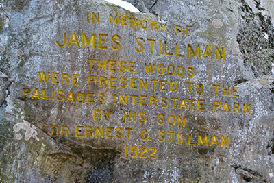
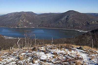
| Inscription on stone by the parking area on Route 218 at the end of the Still Springs Trail and the start of the Howell Trail. The inscription reads "In memory of James Stillman. These woods were presented to the Palisades Interstate Park by his son Dr. Ernest C. Stillman 1922" (January 2009) | View across the Hudson River of Breakneck Ridge on the left and Mount Taurus on the right (January 2009). | |
 |
 |
|
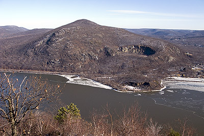
| View across the Hudson River of Breakneck Ridge (January 2009). | View across the Hudson River of Mount Taurus (January 2009). | |
 |
||
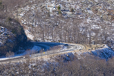
| Looking north from "North Point" Route 9W is on the left and the parking area for hiking on Storm King Mountain is on the right (January 2009). | ||
 |
||
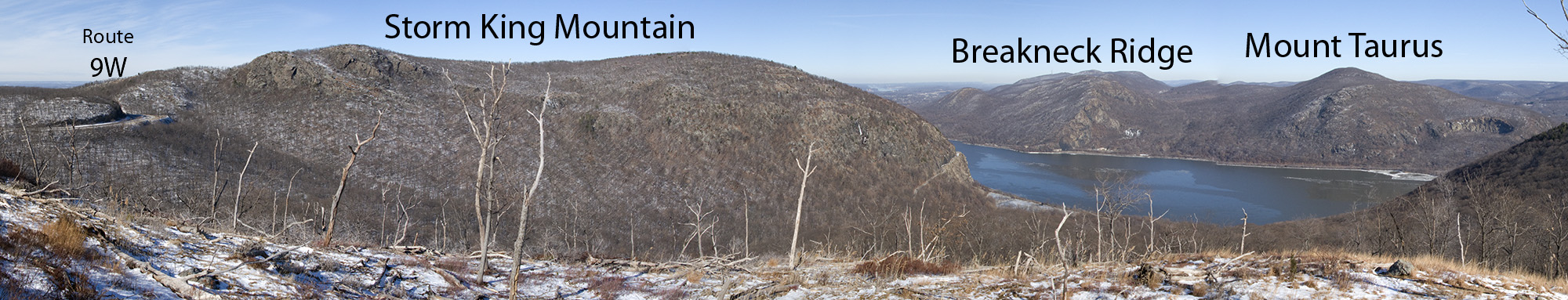
| View from "North Point" (on the Howell Trail) looking northward with Route 9W on the left, Storm King Mountain to the north and Breakneck Ridge and Mount Taurus on the right, across the Hudson River - click on the image to see an even bigger version (January 2009). | ||
 |
||
| Elevation profile for hike (January 2009). | ||
Last updated: 1/2009