|
|
WARNING/DISCLAIMER: Hiking can be dangerous and the information furnished below may contain errors! |
Storm King Mountain Hike
Total Distance: approximately 4 miles
Difficulty: medium, (1,200'+ total elevation gain, small amount of rock scrambling)
Estimated hiking time: 3 - 4.25 hours
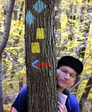
Take the orange blazed access trail from the north end of the parking area up the hill. At the end of the orange blazed trail veer right (to go north-eastward) onto the Stillman trail (yellow blazes). Continue on the Stillman Trail as it passes an intersection with the Bluebird trail (red and blue blazes).
A very nice place to picnic is the an open area with a northerly and easterly view that has a clear view of Breakneck Ridge across the river and comes before the intersection with a white blazed trail (the "By-Pass Trail"). Another very nice place to picnic is an area a little further on with a southerly view (there are a few places near each other with nice southerly views (the second or third one is probably nicer than the first one).
Continue on the Stillman trail until reach the intersection with the Bluebird Trail (red and blue blazes). Make a left onto the Bluebird Trail. Take this until it intersects with the Stillman Trail (yellow blazes) and then make a right onto the Stillman Trail. Take the Stillman Trail until it intersects an orange blazed trail (same one you took originally) and take the orange blazed trail until you reach the parking area.
REFERENCES: NY-NJTC West Hudson Trails Map #113
Driving Directions from NYC
From NYC take the George Washington Bridge to the Palisades Interstate Parkway (going north). Take the Palisades Interstate Parkway for about 40 miles until its end where you pick up Route 9W North at a traffic circle just before the Bear Mountain Bridge (do not cross the Bear Mountain Bridge).
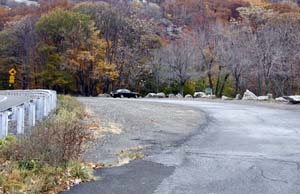
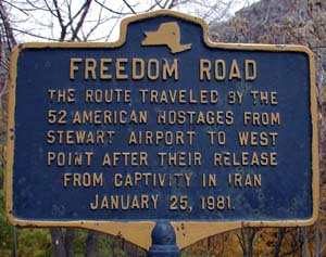
Take Route 9W North for about 8.5 miles until a large (unpaved) parking area on the right. This parking area comes while the road is curving towards the left and the road is peaking a hill. It is the second obvious parking area (GPS: N 41.42443, W 074.00143). There are two historical markers in the parking area, one of which is titled "Freedom Road".
You have gone a little too far if you see either Mountain Road or Storm King School on your right.
The total driving distance is about 54 miles and the average driving time is estimated at 1 hour without traffic.
NOTE: There are a multiple of parking areas on the right (northbound side) in this part of Route 9W. Please make sure you are in the correct one. For this hike, that would be the one where there is a historical marker in the parking area that talks about "Freedom Road". This parking area comes after (north of) the parking area for the Southern Storm King State Park hike. If you miss the parking area it is difficult to make a "U" turn in this section of Route 9W so I suggest driving slowly once you reach the vicinity of the parking area. The photo's below should (hopefully) help you figure out which is the correct parking area.
Click here for What to Bring on a Hike
Click here for Information for Group Hikes
Questions: Michael Brochstein
 |
 |
|
| Parking area. | ||
 |
 |
|
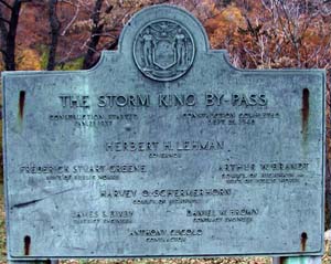
| Signs in Parking area. | ||
 |
||
| Photo of blazes signifying a left turn onto the Bluebird trail and this page's author. (photo by Joel Miller) | ||
 |
||
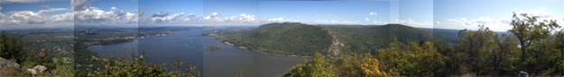
| Northward view of Hudson River from Storm King Mountain. (October 2003) | ||
 |
||
| Southward view of Hudson River from Storm King Mountain. (October 2003) | ||
 |
||
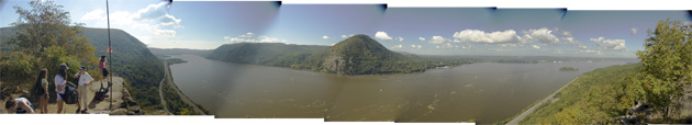
| View of Storm King Mountain (the "hump" in the middle above) taken from Breakneck Ridge which is directly across the Hudson River. (September 2004). | ||
 |
||
| Pollepel (Bannerman) Island (October 2003) | ||
 |
||
| Elevation profile for hike. | ||
 |
 |
|
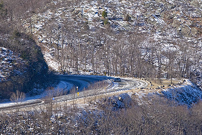
| Route 9W on the left and the parking area for hiking on Storm King Mountain on the right (January 2009). | View from Storm King Mountain area of Breakneck Ridge. Breakneck Ridge hikers start at the bottom, near the water, just to the left of the ridge and then goes straight up the ridge which is slightly right of center in the above image. (January 2009). | |
 |
||
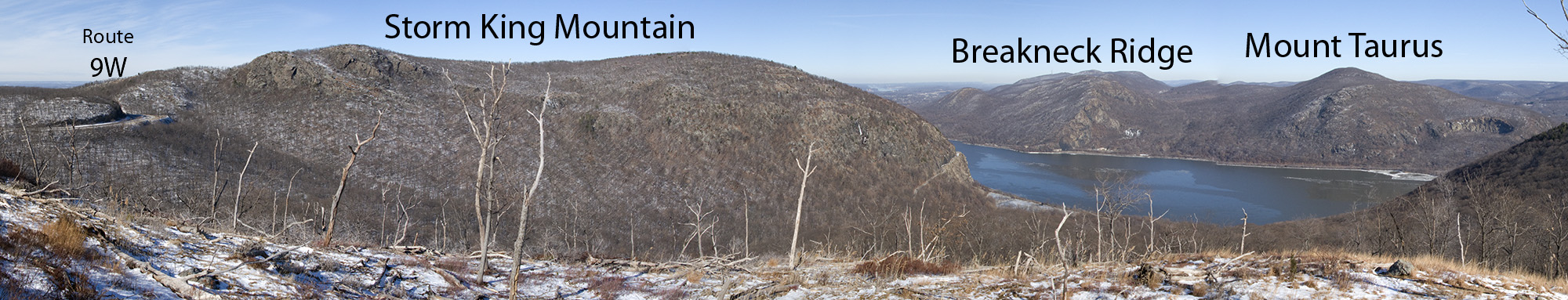
| View from "North Point" (on the Howell Trail) looking northward with Route 9W on the left, Storm King Mountain to the north and Breakneck Ridge and Mount Taurus on the right, across the Hudson River - click on image to see an even bigger version (January 2009). | ||
 |
||
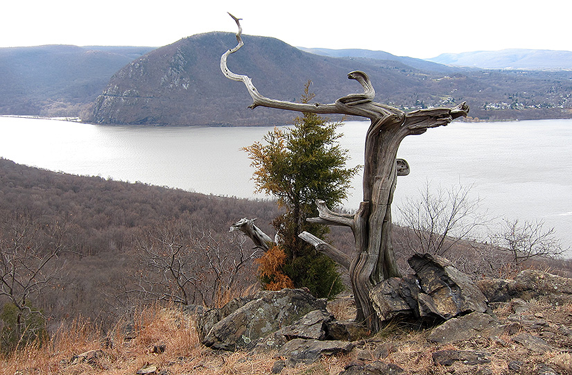
| View of Storm King Mountain (behind tree, across the Hudson River) from Sugarloaf Mountain. (December 2010) | ||
Last updated: 12/2010

Signs that used to be in the parking area
(not the usual one seen in local hiking areas!).