|
|
WARNING/DISCLAIMER: Hiking can be dangerous and the information furnished below may contain errors! |
Macedonia Brook State Park Hike
Distance: 4.4 miles
Time: 3+? hours (group)
Difficulty: moderate
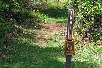
Just north of the park office and on the same side of the road (Macedonia Brook Road) as the park office is the start of the orange blazed trail. Take the orange blazed trail going north for about 1.4 miles (it will be in the form of a grass covered dirt road for most of its length and is not always well marked). At some point a white trail will coincide with the orange trail (stay on the orange trail). You will pass a white and then a green trail on your left (stay on the orange trail). At what appeears to be a fork in the road (soon after you may pass a vehicle barrier gate) veer to the left to stay on the trail.
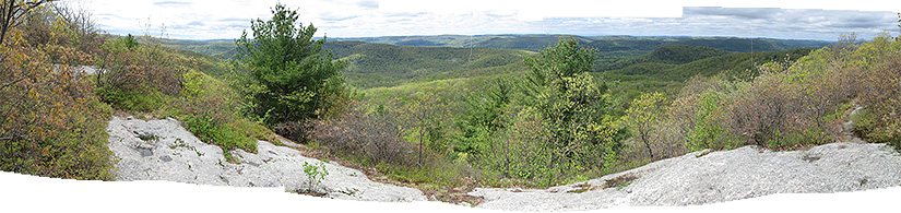
Make a left onto the Macedonia Ridge trail (blue blazes) (you'll be heading west or south). Take this trail up and over the mountain. The first view you reach (straight ahead) just when summiting the mountain is nice but you should walk about 100 feet or so further until you reach a large rock outcropping (with room for 30+ people) with a 180 degree view (eat lunch here!). Continue on the blue trail until you reach main road (Macedonia Brook Road) that runs through the park (and you drove in on). Make a left onto the road and in less than a half-mile you will reach the park office and your car.
References:
- Free color hiking map:
http://www.ct.gov/deep/lib/deep/stateparks/maps/macedonia.pdf
- General park info:
http://www.ct.gov/deep/cwp/view.asp?a=2716&q=325234&deepNav_GID=1650
Driving Directions from New York City
Take the West Side Highway/Henry Hudson Parkway North into the Saw Mill River Parkway North to its end where it joins up with Route 684 North. Take Route 684 north to its end where it joins up with Route 22 North. Take Route 22 north towards Pawling and (later) Wingdale.
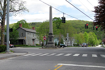
In Wingdale, about a half-mile after passing the "Harlem Valley - Wingdale" train station on your left, leave Route 22 and take Route 55 eastbound by veering right at the fork in the road. You will drive into Connecticut and in about 2.7 additional miles (on Route 55) intersect Route 7. Make a left onto Route 7 (North). In about 6.5 miles, in the center of the town of Kent, CT is an intersection with a traffic light and a tall granite spike (or whatever a monument like this is called). This is also the junction of Route 7 and Route 341. Make a left onto Route 341 (West).
After 1.7 miles on Route 341 you will reach Macedonia Brook Road where a sign directs you to the park.
Make a right turn onto Macedonia Brook Road and follow the road until a sign (at the left side of a fork) for the park. Drive into the park to the parking area opposite the small park office (on the left). The distance from the Route 341 to the park office is about 1.8 miles. (GPS: N 41.76632 , W 73.49492).The total driving distance is about 86 mile and should take no longer than two hours under normal traffic conditions.
Click here for What to Bring on a Hike
Click here for Information for Group Hikes
Questions: Michael Brochstein
 |
 |
|
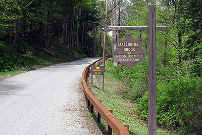
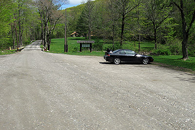
| Sign at the entrance to Macedonia Brook State Park. The second sign states that the Park Office is one mile further. (May 2009) | The parking area opposite the Park Office. (May 2009) | |
 |
 |
|
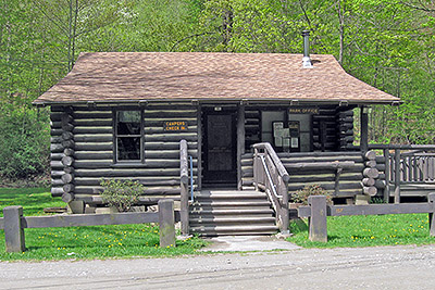
| The Park Office. (May 2009) | The start of the orange trail where you will begin the hike. (May 2009) | |
 |
||
| The "spike" in the center of Kent, CT at the intersection of Route 7 (Main Street) and Route 341 (Bridge Street). (May 2009) | ||
 |
||
| A panoramic view from the top of the summit ridge (May 2009). | ||
 |
||
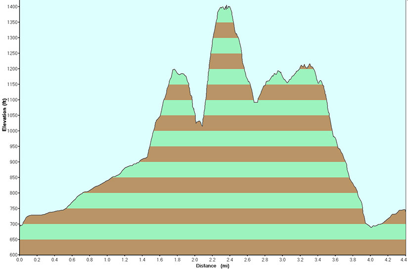
| Elevation profile (May 2009) | ||
Last updated: 5/2009