|
|
WARNING/DISCLAIMER: Hiking can be dangerous and the information furnished below may contain errors! |
The Timp & the Anchor Hike
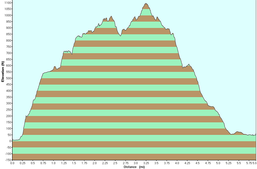
Distance: 6 miles
Time: (3+ - solo), 4-5 hours - group
Difficulty: moderate - strenuous (1240'+ elevation gain)
Take the Timp-Torne Trail (TT, blue blazes) westward from the road. The trail is found about 200+ feet south of the parking area and may not be obvious from the direction you are coming from due to dense foliage. Stay on the TT as the Ramapo-Dunderberg Trail (RD, red blazes) splits off to the right and as it intersects with the 1777 Trail (red blazes). Take the TT all the way to the top of The Timp. Enjoy the view!
Reverse direction. Take the Timp-Torne trail (blue blazes) for a little over 0.6 miles until you reach the 1777 trail (red on white "1777" marker discs). (Do not go right onto the "Red Timp" trail, white circle with red outline and red cross through it, that is found much closer the The Timp.) Do not go left onto the red blazed Ramapo-Dunderberg trail which you will intersect prior to intersecting the 1777 trail. The intersection of the Timp-Torne and 1777 trails is not well marked!
Make a right onto the 1777 trail and take it directly back to Route 9W. Make a left onto Route 9W, the parking lot with your car is about 0.7 miles north on Route 9W.
References: NY-NJ Trail Conference Trail Map #119 (Northern Harriman - Bear Mountain Trails).
Driving instructions from New York City
Take the George Washington Bridge to the Palisade Interstate Parkway North, exit at exit 15, turn left (eastward) towards Stony Point (Route 210 East which is also State Route 106 East at this point), at the end of Route 210, turn left onto Route 9W North (if you went straight by accident you would enter a shopping center).
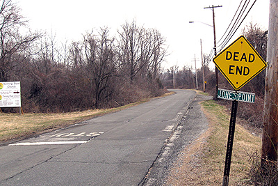
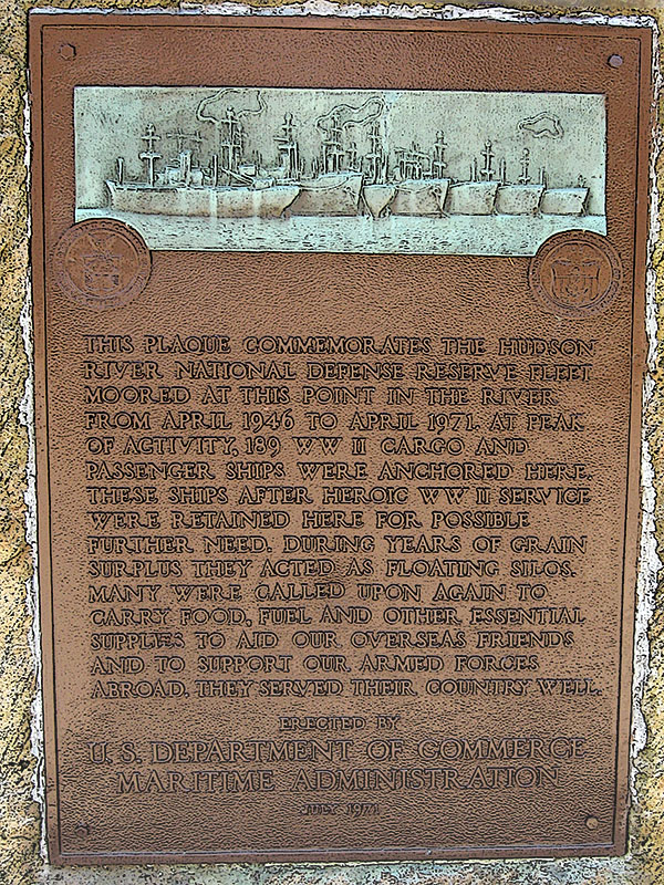
After about 4.4 miles watch carefully for a Dead End sign on the right side that says Jones Point below it. Park in the parking lot on the left side of Route 9W (opposite the Dead End sign/turn-off for Jones Point). You will pass a large ship anchor monument on the right before reaching the parking area (GPS: N 41.28109, W 073.96301).
If you pass the entrance to Bear Mountain State Park, you have gone a few miles too far (turn around and go back south on Route 9W and look carefully on the left for the Dead End sign that says Jones Point below it). The total driving distance from NYC to the trail head is about 44 miles.
Public Transportation
From the Port Authority in New York City there is a bus that leaves people off on Route 9W near Jones Point and the trailhead.
Click here for What to Bring on a Hike
Click here for Information for Group Hikes
Questions: Michael Brochstein
|
|
 |
|
|
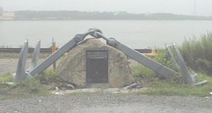
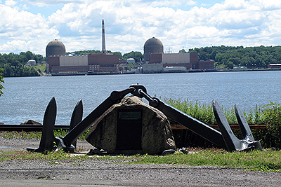
The ship's anchor you will pass on Route 9W south of the parking area. (August 2001 and July 2009) |
||
 |
 |
|
|
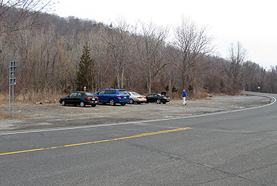
The parking area. (March 2009) |
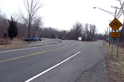
View of Route 9W (looking north) with the parking area on the left and the dead end road to Jones Point on the right. (March 2009) | |
 |
 |
|
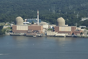
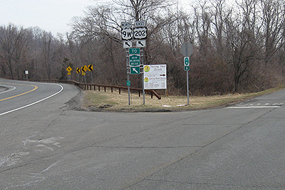
| A "nuclear" view from the Timp-Torne Trail (July 2005). | Signs near the parking area (from image directly above) between Route 9W (on left) and dead-end road to Jones Point (on the right). The green sign refers to the Bear Mountain Bridge. (March 2009) | |
 |
 |
|
| The dead end road going to Jones Point opposite the parking area. (March 2009) | ||
 |
 |
|
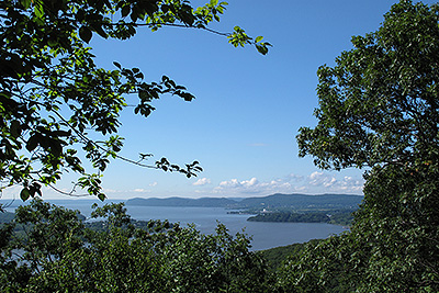
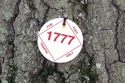
| A view of the Hudson River from the Timp-Torne Trail (July 2009). | The 1777 Trail trail markers. (July 2009). | |
 |
||
| The start of the Timp-Torne and Ramapo Dunderberg trails (at Route 9W). Visibility (as of when this photo was taken) of this trailhead is not good when walking from the north. (July 2009) | ||
 |
||
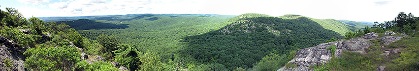
| 270 degree panoramic view from "The Timp". New York City's skyline can be seen in the distance on a clear day. (July 2009) | ||
 |
||
 |
||
| Plaque by ship's anchor monument on the side of Route 9W. (April 2010) | ||
Last updated: 4/2010